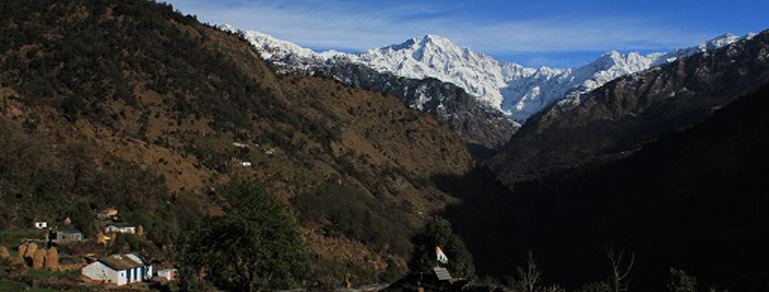
Geography of Uttarakhand
Located at the foothills of the Himalayan mountain ranges, it is largely a hilly State, having international boundaries with the Tibet Autonomous Region of China to the north; the Sudurpashchim Pradesh of Nepal to the east; the Indian states of Uttar Pradesh to the south and Himachal Pradesh to the west and north-west.
It is rich in natural resources especially water and forests with many glaciers, rivers, dense forests and snow-clad mountain peaks. Char-dhams, the four most sacred and revered Hindu temples of Badrinath,Kedarnath, Gangotri and Yamunotri are nestled in the mighty mountains

Uttarakhand has a total geographic area of 53,483 km², of which 86% is mountainous and 65% is covered by forest Most of the northern parts of the state are part of Greater Himalaya ranges, covered by the high Himalayan peaks and glaciers, while the lower foothills were densely forested
The highest elevations are covered by ice and bare rock. Nanda Devi is the highest land point of Uttarakhand with the altitude of 7,816 metres (25,643 ft) above sea level.
Nature is the biggest appeal of Uttarakhand tourism. The state has preserved and restored several national parks. Some of the parks you should visit are Jim Corbett National Park -India’s oldest national park, Rajaji National Park near Haridwar, Govind Pashu Vihar National Park and Gangotri National Park near Uttarkashi. In Chamoli District there are two UNESCO World Heritage Sites - Valley of Flowers National Park and Nanda Devi National Park.